State St. & harrison's extreme street makeover
Tell us what you think:
What is going on at State St. and Harrison Ave. in Cramer Hill? Quick facts are found on the flier below:
The City of Camden, Camden County, Camden Community Partnership (CCP), and the Delaware Valley Regional Planning Commission (DVRPC) are working together to redesign State Street and Harrison Avenue in Cramer Hill. DVRPC, the Federally-designated metropolitan planning commission for the Greater Philadelphia Region, conducted a road safety audit at the intersection of State and Harrison in 2021. Following the audit, CCP, Camden County, the City of Camden and DVRPC had the opportunity to put some of the recommendations from the audit to the test through DVRPC's Experimental Pop-ups (Expo) program.
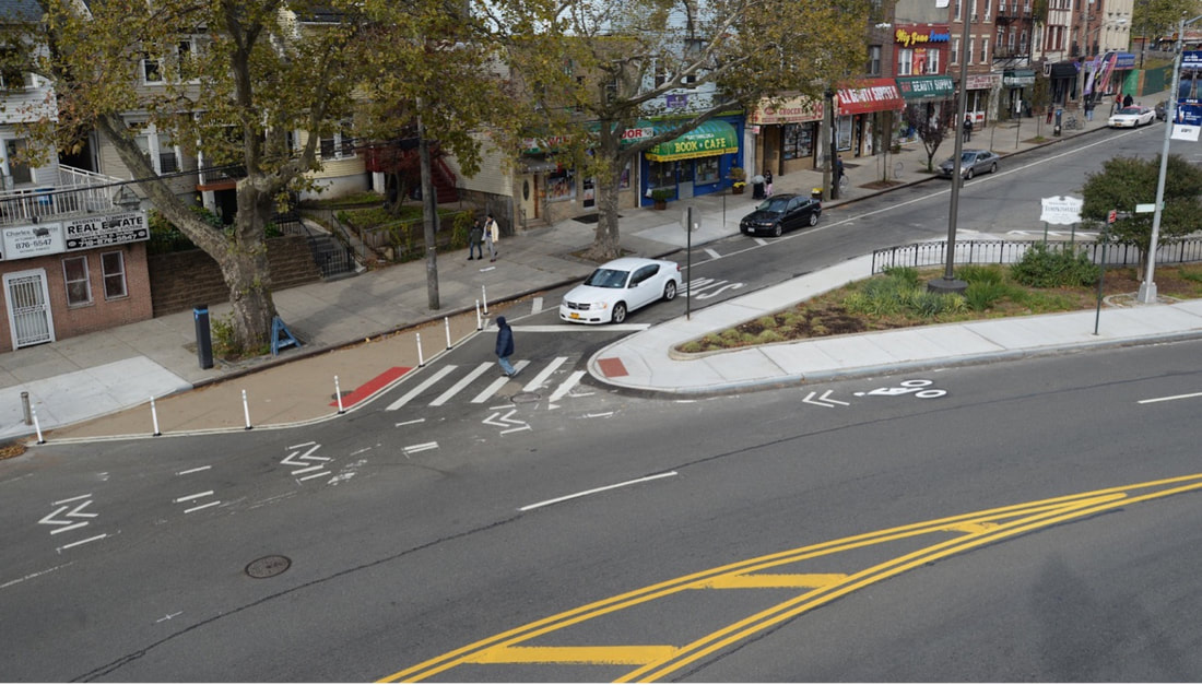
Expo uses quick-build strategies, in partnership with local roadway owners, to test innovative infrastructure solutions to safety and transportation challenges. In the case of State Street and Harrison Avenue, this includes creating parking-separated bike lanes and improving pedestrian crossings at bus stops and key intersections, particularly the intersection of State and Harrison. For instance, the Expo project seeks to calm turning movements by creating a bump out at the northwest corner of the intersection. This intervention has the effect of making the movement of turning vehicles slower and more predictable.
The goal of Expo projects is to bring these solutions to communities through rapidly deploying low-cost interventions. The Expo project at State and Harrison will be completed by the end of fall 2023 and is partially funded by AARP. Before and after speed and volume data will be taken and the project team will gather feedback from the community and other stakeholders as well. This will help to inform permanent changes to the roadway when Harrison Ave is reconstructed in the near future, and eventually State St as well.
The project:
The design for the Expo project at State St. and Harrison Ave incorporates the following elements:
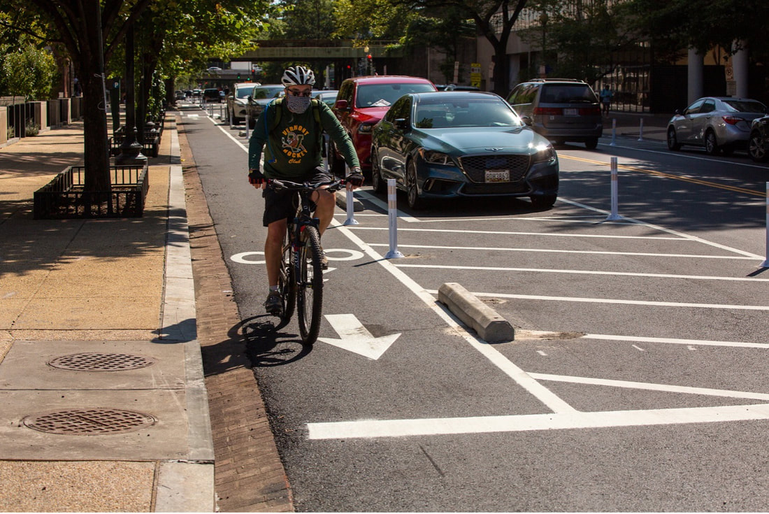
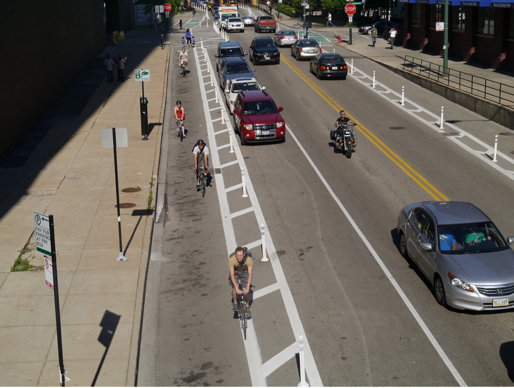
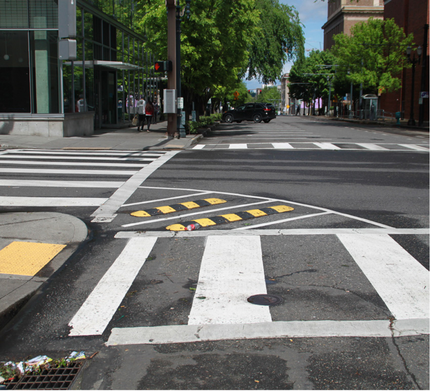
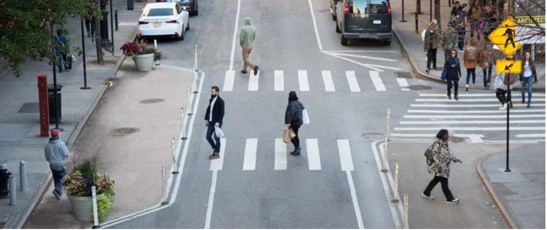
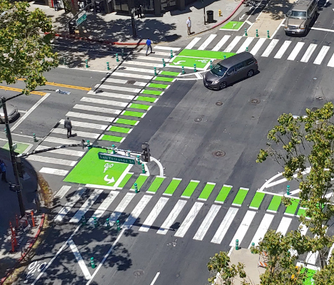
- Parking protected bike lanes with bollards: these separate the road between motorists and bicyclists to improve safety for bicyclists (pictured below)
- Curb Extensions: these narrow the roadway forcing motorists to slow down and also shorten the distance pedestrians need to travel from curb to curb (pictured below)
- Dedicated bike turning lanes: these ensure that bicyclists have priority in the shared road space, thus protecting them (pictured below)
FAQ:
Frequently Asked Questions:
What’s happening on State Street and Harrison Avenue?
This traffic calming project aims to make State Street and Harrison Avenue safer for all, especially for people walking, biking, and taking transit by slowing auto traffic and including infrastructure that makes biking safer (protect bike lanes) and walking safer (improved crosswalks). The Camden County Municipal Utilities Authority (CCMUA) will also be collecting stormwater data to inform the future design of flood mitigation infrastructure in the area.
Why is this project happening?
These streets and this intersection have a history of safety issues, including the death of someone walking in 2019. These issues were documented in the 2021 road safety audit. In addition to making the area safer for people walking, biking and taking transit, project partners want more people to feel comfortable walking, biking and taking transit to the Cramer Hill Park and the Kroc Center. Finally, these streets were identified as important parts of the bike network in Walk & Bike Camden!: A Community Vision for Active Transportation. https://www.walkbikecamden.com/
What data will be collected during the project?
We will gather before and after traffic counts and speeds, bicycle counts, pedestrian counts, and public survey responses, and do onsite observations. This data will inform the evaluation of the success of the implementations. As mentioned earlier, the CCMUA will also be collecting stormwater data to inform the future decisions on flood mitigation infrastructure in the area.
Will businesses and homes still be accessible with the new street designs?
Yes! The redesigned streetscapes maintain all existing driveway access points, and do not remove any legal on-street parking spaces. The improvements have been designed to allow large vehicles like delivery trucks and NJ TRANSIT buses to continue to navigate these streets safely.
How will we know if this is working or not?
After a period of time, the project partners will evaluate the performance of the new street designs. The Expo team’s collection of traffic data both before and after implementation will determine next steps. For example, if the average vehicle speed is lower after implementation, we know that the improvements improved safety for all road users. Beyond data, the project team will be distributing a community survey to gauge public feedback on the project.
How can I stay engaged on this project?
Take the project survey linked above! Your feedback will be used to evaluate the project once implementation is complete. You can also contact Brian Fisher of CCP at [email protected].
Check out the Connect the Lots (CTL) Events Calendar to check out programming at Cramer Hill Waterfront Park and other open spaces in Camden:

